The Trans-Flores route is the main east–west national road across the island of Flores. It links Labuan Bajo in the west with Larantuka in the east and passes through the island’s main towns on the way. This page explains how the route is divided, which towns connect its legs, and how it differs from the separate North Flores road. It does not give timetables, fares, transport operators or day-by-day plans.
What the Trans-Flores route is
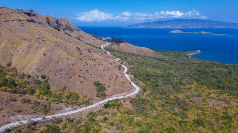
The Trans-Flores road runs along the length of Flores through the central highlands rather than along the coast. The Ministry of Public Works (Bina Marga) gave its total length as 661.5 km in a statement dated 2 May 2016. The ministry divides the road into five legs, each named after the towns at its ends.
Because the figures below come from 2016, they are best read as a guide to the road’s structure rather than as exact distances today.
The five legs
| Leg | Official length (2016) |
|---|---|
| Larantuka–Maumere | 138.8 km |
| Maumere–Ende | 141.3 km |
| Ende–Bajawa | 123.3 km |
| Bajawa–Ruteng | 136.6 km |
| Ruteng–Labuan Bajo | 121.5 km |
Adding the four western legs together, Maumere to Labuan Bajo comes to 522.7 km. That total is a sum of the official legs, not a separate published figure. Other sources give different totals and leg lengths, possibly because they measure from different start and end points. This page uses the official figures only.
The towns that connect the legs
Reading the route from west to east, these are the places where one leg ends and the next begins.
Labuan Bajo is the western end of the road. If you are still working out how to reach it, see how to reach Labuan Bajo.
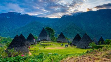
Ruteng joins the first two legs: Ruteng–Labuan Bajo to the west and Bajawa–Ruteng to the east. Travellers heading for the village of Wae Rebo also pass through Ruteng; see the Wae Rebo page.
Bajawa sits between the Bajawa–Ruteng and Ende–Bajawa legs.
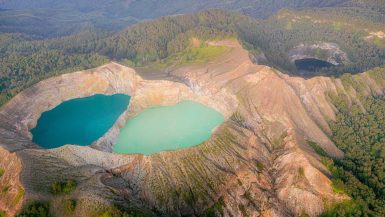
Ende is the point where the Ende–Bajawa and Maumere–Ende legs meet. Readers interested in the island’s crater lakes can read the Kelimutu page.
Maumere joins the Maumere–Ende leg to the Larantuka–Maumere leg.
Larantuka is the eastern end of the road.
Why the road is slow
Bina Marga describes the road as winding and uphill, and notes that this makes some locations prone to landslides. The highlands that the route crosses are steep, and cutting a road into steep slopes leaves them vulnerable after heavy rain or an earthquake. For that reason, distance alone is a poor guide to how long any part of the route takes, and this page does not give travel times.
Trans-Flores road and North Flores road
The North Flores road (Jalan Lintas Utara Flores) is a different project from the Trans-Flores road, and the two should not be confused.
According to the Minister of Public Works, as reported on 31 October 2026, the North Flores road is planned at 472.48 km. About 385.07 km of it is asphalted and about 87.41 km is unpaved. The reported segments are Labuan Bajo–Bari (83.52 km), Bari–Kedindi (57.77 km) and Wae Gongger–Maumere (331.19 km). The stated target for completion is the end of 2028.
Because the northern road is still being completed, this page does not treat it as a route. It is mentioned only so that readers who see both names know they refer to separate roads.
Road status after the August 2026 earthquake (checked 20 November 2026)
A magnitude 7.7 earthquake struck Flores on 15 August 2026. The Ministry of Public Works reported that by 16 August nine national road sections had been made functional, eight on the Trans-Flores route and one on Ruteng–Reo–Kedindi. On 18 August the ministry said all affected national Trans-Flores sections were functional, with 40 landslide points and four road-surface faults handled. The Ende–Bajawa section had been reopened after a landslide.
Later reports recorded 94 damaged road and bridge points by 20 August (75 landslides, three road collapses and 16 bridges and culverts). By 5 September the ministry reported 19 national and regional road sections in Flores as functional. The section counts differ because the reports cover different scopes and dates.
These are the latest official reports found at the time of checking. Conditions can change, especially after heavy rain or aftershocks, and the reports are not a guarantee of current road conditions.
Where this page fits
This page covers the road itself. For Komodo boat trips, see Komodo boat-trip itineraries; that page covers boat trips only and does not include overland plans across Flores.
Frequently asked questions
It is the national road across Flores between Labuan Bajo in the west and Larantuka in the east. The Ministry of Public Works gave its total length as 661.5 km in 2016.
The five legs connect Labuan Bajo, Ruteng, Bajawa, Ende, Maumere and Larantuka. Moni, the village nearest Kelimutu, lies off the road beyond Ende.
According to the 2016 figures, Larantuka–Maumere is 138.8 km, Maumere–Ende 141.3 km, Ende–Bajawa 123.3 km, Bajawa–Ruteng 136.6 km and Ruteng–Labuan Bajo 121.5 km.
No. They are separate projects. The North Flores road was reported on 31 October 2026 as 472.48 km long, with a target completion at the end of 2028.
The Ministry of Public Works reported damage and landslides after the 15 August 2026 earthquake, and on 18 August said all affected national Trans-Flores sections were functional. The latest official reports found date from 5 September 2026, and conditions can change, so this answer is a dated summary, not a current guarantee.